


Archipelago Dip
LOCATION-August 2013
By Sandy Lang
Photographs by Peter Frank Edwards
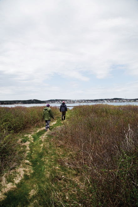
I have this dream of sea kayaking again to some of the uninhabited islands of granite and spruce near Stonington. A half-day trip once with friends in balmy August is still bright in my mind. We all ended up jumping into a deep, clear quarry pond. Ever since, I’ve wanted to see more of the Deer Isle archipelago. The water view from hilly Stonington’s lobster pounds and docks seduces me on every visit. More than 50 islands known as Merchant’s Row rise up from the seawater, out to Isle au Haut and east into Blue Hill Bay.
Bill Baker, who has built up Old Quarry Ocean Adventures as a bunkhouse, campground, and launching point for sea kayakers on nine acres on a cove near Stonington, tells me that a couple of sea kayak instructors are leading a two-week course for would-be Maine Guides that will include an overnight of camping on one of the islands. Maybe they’d let us tag along for a day or two, he says. The “us” is photographer Peter Frank Edwards and myself. He’s got island dreams, too.
Within minutes, I’m on the phone to pose the idea to the instructors. No, we haven’t done extensive sea kayaking. But we have plenty of experience with paddling kayaks—most recently in summertime, on calm lakes. Yes, I imagine this will be more strenuous. Not wanting to lose this archipelago opportunity, I firmly and confidently promise we’ll keep up and not be a drag on the group. With that vow, we’re in. Peter Frank will do this handily, I’m sure, but after hanging up, I glance down at my arms and hope I truly am fit for the challenge.
Onto a blue trail
A few days before we’re to meet for that excursion, we drive to Deer Isle to hitch a boat ride with Sid Quarrier, a sea-captain-looking retired geologist from Appleton who was an early volunteer with the Maine Island Trail Association (MITA). For 25 years, the group has promoted the idea of Maine’s coastline as a nautical trail—a 375-mile water wonderland strung with wild shoreline and thousands of islands to be explored. Quarrier describes it as akin to “an Appalachian Trail on the water.” Volunteers like him sign up to be island stewards and “island adopters,” who hop in boats to check on the campsites throughout the summer season. The organization promotes and encourages “leave no trace” use of the islands.
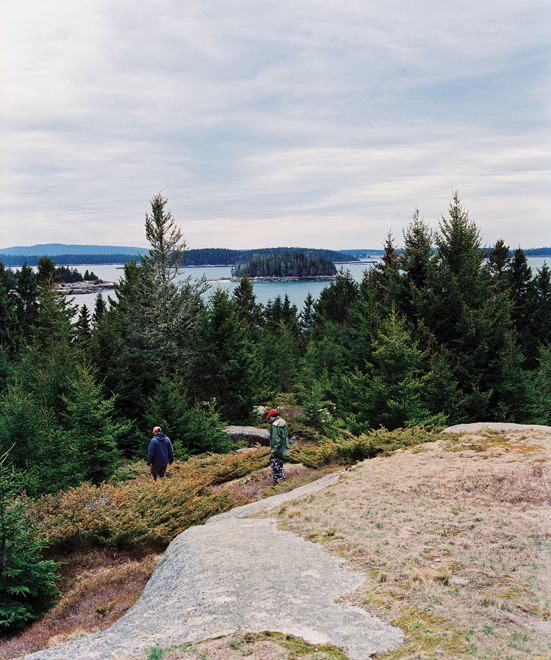
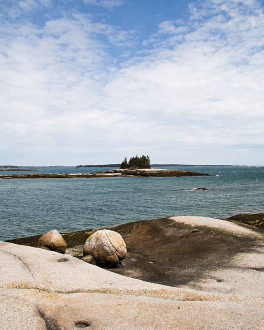
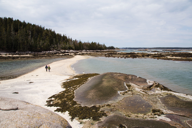
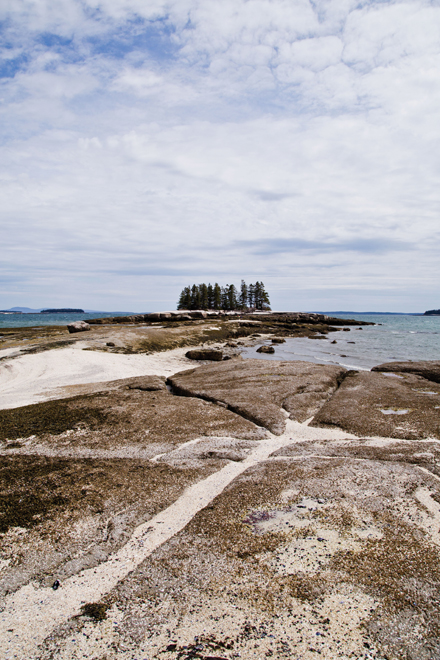
The jaunt on Quarrier’s boat is a chance to motor around the waterscape we’ll soon be paddling. It’s a raw weather day, and Quarrier lends us extra jackets and pants to block the wind. We stop first at Hell’s Half Acre, an island that looks more like an Eden, with sheltered beaches and broad ocean-facing campsites protected by stands of salt-tolerant spruce. Back in the boat, we make our way to a long sandbar and follow its narrow spine to the sharp rise of the tiny, rock island outpost, Shivers. Here, there’s room for just one tent—maybe two, but they’d have to be pups. From that perch we sit high and dry on rocks and look back toward Stonington in the distance while we unpack lunch sandwiches and talk awhile.
This archipelago is unlike anyplace else on the East Coast, explains Quarrier and Brian Marcaurelle, of the MITA staff. It’s a treasure of conserved and public lands because of the efforts of recreation and conservation groups like MITA, Maine Coast Heritage Trust, Acadia National Park, the State of Maine, the Chewonki Foundation, and Island Heritage Trust. Many privately owned islands are also part of the MITA list. “One by one, owners have learned that it’s safe and okay for islands to be available for public recreational use,” according to Macaurelle.
In the rush of cold ocean winds and vivid sunlight, we zip around to others nearby—large Russ Island with its hiking trails to impressive hilltop views; Steves Island’s idyllic sandy beaches and mossy hills strewn with spruce cones, and distant views of both Isle au Haut and Stonington; and we pull ashore at Rock Island’s golden beach that looks perfect for a lobster picnic, and is practically within swimming distance from the Stonington wharves. All of the islands are remarkably clear of trash and relatively unscathed by use. Volunteers must be diligent and the visitors have learned to be respectful, I surmise. Quarrier nods, adding that harsh coastal weather keeps people off the islands for much of the year. “The saving grace out here,” he says, “is winter.”
Before we leave the v-hull skiff, I ask for advice about how people can best make a foray into the Maine Island Trail by kayak. If all you’ve done is freshwater kayaking, that may not translate, the men tell me. Macaurelle says that in order to enjoy all of the natural beauty, kayak paddlers also have to deal with wind, tide, fog, tricky navigation (islands look deceivingly similar), and very cold water.
Zipped up and dry
Two days later, we again drive past massive pink gray blocks of granite to the hub of Deer Isle sea kayaking at Old Quarry. Nate Hanson greets us first. A Registered Maine Guide who lives in Ellsworth, he’s serious about sea kayaking and spent part of the winter on a kayak trip in Great Britain. The other instructor is Michael Daugherty, who writes a blog about kayaking around Stonington. He and his wife, Rebecca, operate the Isalos Fine Art gallery, which Daugherty mentions will be holding an archipelago-inspired show opening in September. To prepare, he’s garnered help from Old Quarry to bring artists out to the islands. Bill Baker is on the grounds, too, busy getting his tour boat Nigh Duck ready for the season, often with his coal-gray standard poodle bounding nearby.
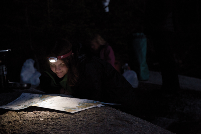
We make our way to the beach, where the instructors and three students are starting to pack the kayaks we’ll use, putting clothes, sleeping bags, and tents into dry bags and then stuffing them into covered hatches on the boats. We join in and next is the feat of pulling on drysuits, which look like a cross between astronaut garb and snowmobiling suits. Wearing just one layer beneath, you step in, zip up, and push your feet, hands and head through snug, rubbery cuffs intended to keep all water out. I’ve never been wrapped so securely. The anticipation for this adventure is high, and after the guides share some safety information, we’re finally grabbing paddles and pushing each other’s boats out onto the water.
Maine’s Caribbean
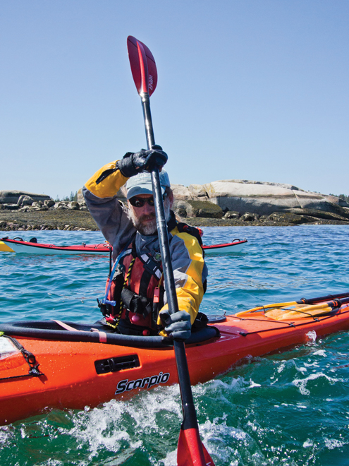
The water is choppy and the sunshine bright, and to cross channels toward Devil’s Island I’m paddling constantly, while others in the group with better paddling technique seem to be gliding further with each stroke—and with less effort. Seawater splashes across my boat, but a spray skirt keeps water from getting in the cockpit. I dip my bare hand into the chop that’s still in the 40s. Yet the aqua blue tint reminds me of a warm sea, and many of the islands have crushed shell beaches. Replace the spruce trees with palms, and the saltwater scenery in this part of Maine could look almost tropical.
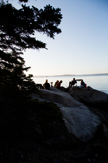
By lunchtime we’ve reached somewhere familiar—we’re again at charming Hell’s Half Acre. As we stretch out on sunny rocks, the students and guides arrange a spread for making wrap sandwiches, including guacamole, hummus, pepperoni, cheese, and sliced vegetables. (As part of the training, the students are in charge of the food that the group needs for the trip.) We all eagerly help ourselves. “Everything tastes better on an island,” someone says. A twenty-something student named Kristie points to a passing lobster boat and wonders aloud if her boyfriend’s boat will chug by. Another student, Charlie, tells us that he built his handsome wooden kayak himself, about 15 years ago. I recall one of Quarrier’s comments about the natural wonders of these islands. “If you lay down on a rock at low tide,” he advised. “You can hear the clicking of the barnacles.”
This is how the first day passes. We see eagles and ospreys overhead, seals lounging on ledges in the distance, and we cross exposed stretches of water in steady breezes. All day, we watch for any of the 30 or 40 lobster boats in the local fleet that may come churning past. I’ve heard the old joke that kayaks are “speed bumps” to the fishermen, and we give every boat we see a wide berth.
Island overnight
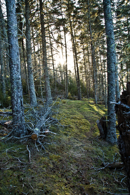
That afternoon, some three miles from the Stonington waterfront, our fleet of kayaks makes it to a cozy horseshoe cove on 78-acre Saddleback Island. We’ll camp here, in the woods that overlook the beach. (This island’s not on the MITA lists, but the instructors say they’ve made special arrangements for the stay with Maine Coast Heritage Trust.) Before dark, we each have much to do, including pitching our tents and hiking around a bit to see if we can find the island’s sole, 1950s-era cabin. According to MITA’s trail guides, many of the other small islands nearby once had buildings, and were named for historical, often agricultural uses—Apple, Wheat, Potato, Sheep, Little Hog, and so on. Millet Island is in near view from Saddleback.
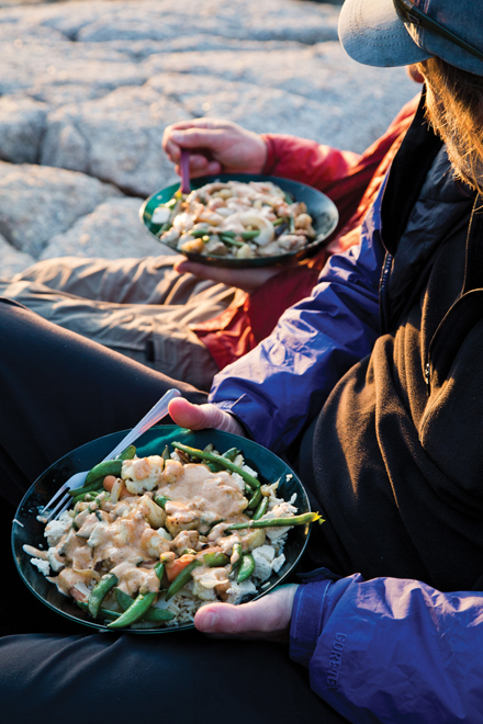
The students cook a hot supper for everyone on two small, sometimes teetering gas stoves—somehow managing not to topple the cookware, and to serve up green salads and then heaping plates of sauteed tofu, chicken, and vegetables with a peanut sauce. We eat and talk in a wash of late-day, golden light. As the sun finally sets on the now-calm water and air temperatures drop into the 40s, conversation begins to slow and we all make our way to tents. Just outside the tent’s fabric walls, various mixes of loons, gulls, crows, mourning doves, sparrows—and other unidentified birds—repeatedly hit crescendos of calls and songs. Coyotes yelp from somewhere across the water. It sounds like a pack, and I don’t mind waking to hear them. It’s just too amazing to think that besides the birds and other creatures of the night and early morning, we have the island to ourselves.
After rising early, we meet for coffee and French toast near the stoves that are set again on the rocks, and before long, we’re packing up and getting back on the bays. It will take another several hours of paddling for the return trip. By mid-morning, we follow the shoreline of islands, pull ourselves through whitecaps at the parts most exposed to the Atlantic, and see scads of seals in the distance.
Since that fleeting, summer plunge years ago, I have wanted to explore more of these islands close up. With this taste, I now know they are wilder, more beautiful, and more distinct from one another than I had guessed. And even though we’re paddling only a a handful of miles each way, it feels like we’ve gone much farther. The remoteness is instant and real, beginning just yards from the Deer Isle shore. Throughout the trip, it’s almost always possible to see houses or the lights of Stonington in the distance. But we are out here, and that’s there. In such situations, a person quickly changes modes and recalibrates—in the best of ways.
For our final meal together, we make a lunch stop at Buckle Island, and Hanson and Daugherty point out that the island is known for its old-growth red spruce stands and interior trails. But none of us ventures past the rocks and beach to the island’s remaining wonders. We stay together. We’re within an hour of our return to Deer Isle now. In the sleepy afternoon sunshine, I can feel that my wings are tired. But I’m dry. We’re all dry—no one has come close to rolling or capsizing—so once we make it back to Old Quarry, we finally test the suits by jumping into a freshwater pond there. (Waterproof, even when submerged!) The islands are behind us as I peel away the borrowed suit in the glinting light. I am tired in a rewarding, invigorating way—a first-time trail follower who hopes to dip back in again soon.