


The Golden Road
LOCATION-November 2012
By Sandy Lang
Photographs by Peter Frank Edwards
Adventures along the infamous logging road from Millinocket to the Canadian border.
According to the maps in my well-worn copy of the Maine Atlas and Gazeteer, DeLorme’s iconic guide to the state, the Golden Road is a town-less thoroughfare in the North Maine Woods that stretches for more than 90 miles from Millinocket to the province of Quebec. Online, I find conflicting information about the road from various travelers and Mainers. Some express concern about the dangers of driving into such a broad and remote wilderness. A few ask if they’ll need to bring extra tanks of gas—or even survival kits and compasses in case of GPS failure. One man contends that the Golden Road—built by Great Northern Paper and open for public recreational use—is more like Sebago Lake than Siberia, and that its length and dangerousness have been exaggerated. “You people need to get out more,” he posts in an online forum. “It’s only 40 miles from Caribou Lake to Millinocket. We used to drive that in a morning to get more beer!!”
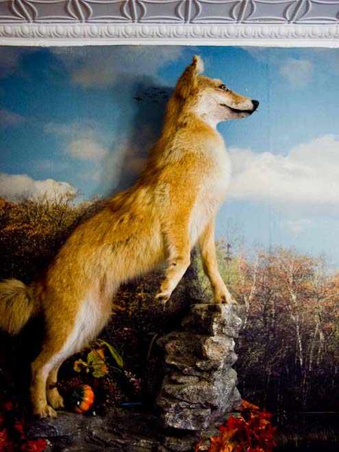
The mixed bag of details about the road intrigues me. What’s the real story? One sunny Saturday, Peter Frank Edwards, my frequent partner on road-trip adventures, and I decide to see for ourselves. We pack the four-wheel-drive station wagon with a cooler of drinks and food, and drive 70 miles north of Bangor, while Peter Frank’s agreeable old hound, Sparky, happily snoozes in the back seat. It’s late morning, and only a few other cars and people are out and about when we drive through downtown Millinocket. The biggest spectacle is the cab of the logging truck jutting out of the second-story façade of the Pelletier Loggers Family Restaurant, which was founded by a Millinocket family which has hauled timber on the Golden Road for generations. We’re just minutes from the eastern end of the Golden Road.
Gold Rush?
Depending on what version you hear, the Golden Road earned its name because the private road cost Great Northern so much to build (the legend is one million dollars per mile), or because it offers a direct passage into one of the largest patches of contiguous forest in the United States, creating new access to the natural riches of northern Maine for the timber industry. Either way, the name invokes images of grandeur. And then you get there.
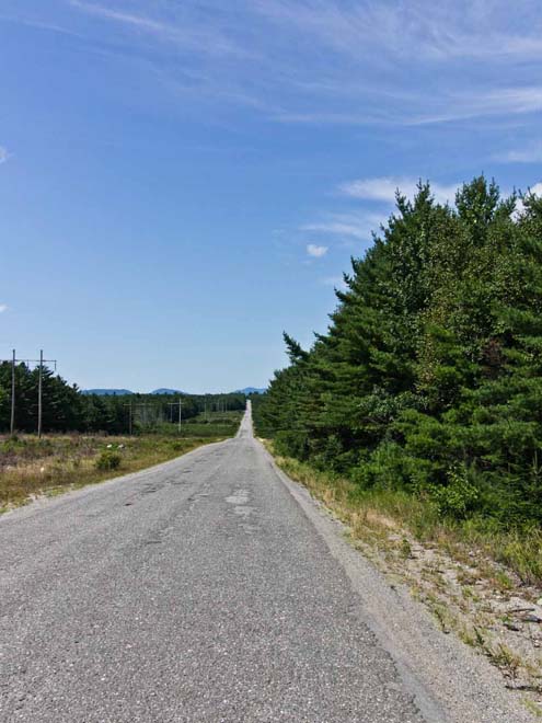
Some first impressions in the opening miles: the roadway is wide and often straight. It is not paved in gold or yellow brick (not so surprising), but it is paved for the first 30-plus miles from Millinocket (pleasantly surprising). While Peter Frank drives I keep an eye out for log-laden trucks and brawny lumberjacks, but I don’t see any. That mystery is solved later in the day when a veteran Golden Road visitor informs me that logging trucks don’t travel the road on weekends.
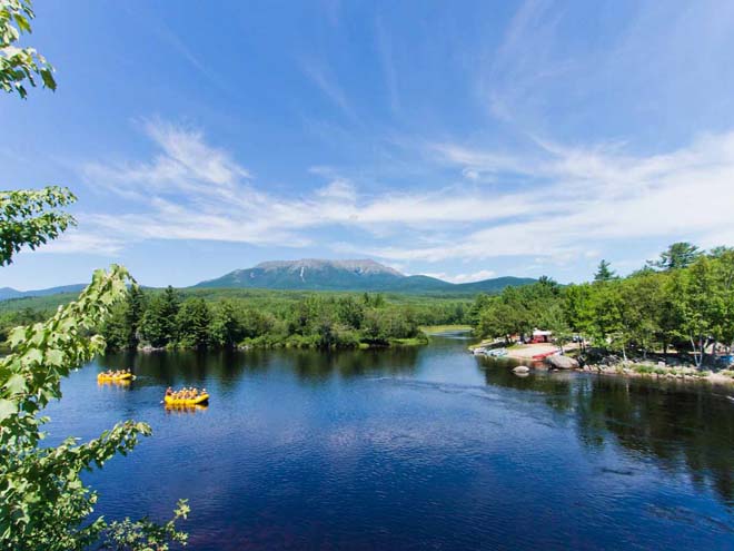
Like a frontier diarist, I jot down notes between the road’s bumpiest stretches. The posted speed limit is 45 miles per hour, and every few minutes a pickup truck passes in the other direction. Trees alongside the road are young and densely packed. In the mile-after-mile scenery of tree after tree, Peter Frank and I start to exchange silly existential questions. “What are we looking for?” “Why are we here?” Then, just shy of 20 miles in, we arrive at a point along the road with some visual relief. The Abol Bridge Campground and Store parking lot is full of people, tents, and trailers. We pull in behind a decades-old school bus that’s apparently transporting river rafters. The one-lane Abol Bridge offers incredible views of Mt. Katahdin in the distance, and just after crossing we stop the car to get out and walk back to the mid-point of the parallel span that’s reserved for pedestrians and snowmobilers (in winter). The West Branch of the Penobscot River rushes below. We see a first, second, and then third inflatable yellow raft full of paddlers in wet T-shirts and shorts float around the bend and under the bridge. On the bridge, I happen to meet the driver of the bus, who’s watching the scene and smiling. “The Golden Road is like our theme park,” he tells me, and adds that we ought to check out an informal whitewater paddling event happening a few miles up the road.
Whitewater and campfires
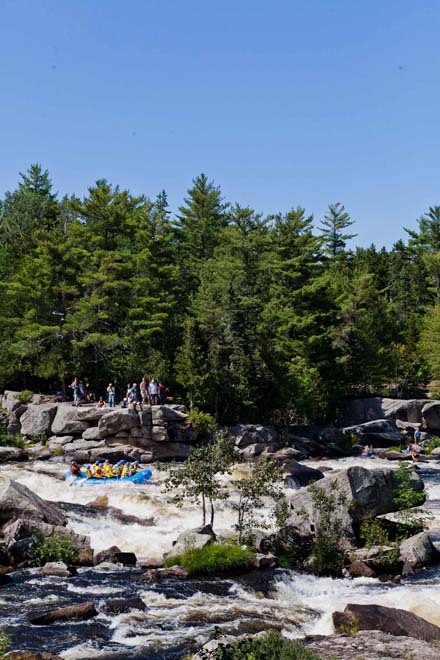
Chewonki Big Eddy Campground is our next stop, with entrances literally a few yards from the Golden Road. The river is roiling in front of the campground office, and across the water, near the far bank, two women are stand-up paddle boarding in the circling current of the eddy. We ask around and learn that the whitewater action is at a different spot on the 75-acre property, along what’s known as the “Cribworks,” a section of challenging whitewater rapids on the West Branch. We make it there in a couple of minutes and see the water roaring by in a white froth over and between huge boulders. Campground sites are on both banks—a nearby one-lane bridge is the access for crossing the river—and spectators are sitting on rocks at the river’s edge. Sparky and I find a perch on a sunny ledge overlooking the scene, while Peter Frank climbs nearby rocks looking for other vantage points. We don’t have to wait long before more of the plump yellow rafts plow through, along with single paddlers in kayaks. Even as an observer, it’s a rush. I see one kayak plunge underwater and disappear for a few moments, fully submerged in the gushing water.
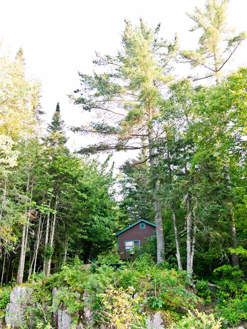
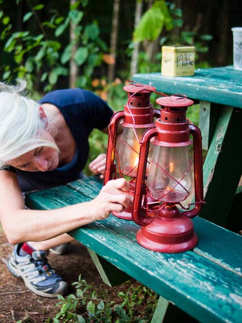
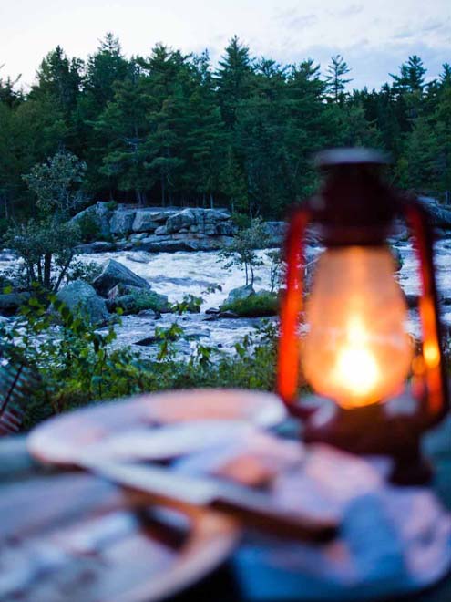
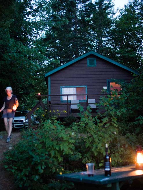
It’s a spectacular setting, and we decide to return to the riverfront later for a cookout. But first, we drive another few miles to the 73-foot-tall Ripogenus Dam, built circa 1920, to check out another campground a few miles off the Golden Road at Frost Pond. To get there, you have to drive on the top of the narrow, 700-foot-long “Rip Dam” (a local nickname). Ripogenus Lake is on one side and a deep West Branch gorge is on the other. Beyond the dam, the forest makes a shady canopy over the road, and the surface of the unpaved road is rocky enough to resemble a dry streambed. After a couple of slow-going miles, we arrive at Frost Pond Camps. No thundering rush of water here. Instead, the depth of the quiet is remarkable—not a manmade hum or buzz or beep to be heard. In the hush of the afternoon, we see four people sitting in wooden chairs by the shore, watching loons. It turns out that two of the people are the camp’s owners, Gene Thompson and Maureen Raynes, who offer to take us (and Sparky) on a tour of the six rustic cabins, most of which are outfitted with woodstoves, bunk-style beds, and mid-century, propane-fueled refrigerators and stoves. We talk about the Golden Road and Thompson says, “You’ve still got three more miles to go before the pavement stops. You haven’t even done it yet.” After dinner that night by a riverfront campfire, a steady rainfall starts, and by early morning we pack up and take a break from the Golden Road journey, deciding we would rather continue on a day of golden sunshine.
all’s quiet on the western front
On a bright Thursday morning a couple of weeks after our first trip, we’re again on our way to the Golden Road. This time, we’ll catch it northwest of Greenville and Rockwood. On the drive north on Route 15, we see the smoking grills at Spring Creek Bar-B-Q in Monson and stop in. Owner Mike Witham is taking orders behind the counter and asks where we’re headed. When we say the Golden Road, the former raft guide with a camp on the Chesuncook Lake fills us in on the conditions of the unpaved stretch. He says, “The dirt part is better than the tar—so smooth a Geo could drive it.”
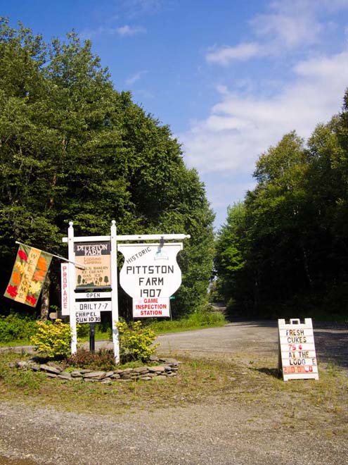
A made-to-order lemonade, barbecued beef sandwich, and a couple of deviled eggs later, we pass through Greenville and Rockwood (yes, my mouth dropped at seeing Mt. Kineo’s formidable rock face jutting out into Moosehead Lake), and then drive some 20 miles up 20-Mile Road to Historic Pittston Farm. We heard that a visit to the old Pittston Farm is a must if you want to be properly introduced to the Golden Road. The last of the outpost farms once operated by Great Northern Paper, the farm dates to the nineteenth century and now includes a lodge, restaurant, cabins, and a chapel, along with a former carriage house that has been converted into motel-like rooms. Solar power is being harnessed to provide electricity—we see a field of the solar panels tilted toward the sun as we drive in—and one of the massive barns is now a museum dedicated to old photographs and tools from the farm and the logging industry before the Golden Road was built.
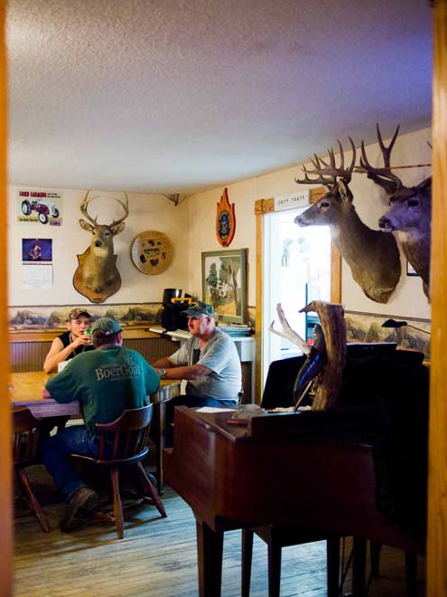
Three generations of the Mills family take care of the farm, which is open year-round. Working with her husband, Bob, and a handful of other staff, Jen Mills says jokingly that they might serve only 15 people a day in the restaurant during the summer, and up to 1,000 people a day in winter, when the snowmobile crowds stop by for the homemade bread, burgers, soup, and pie. Pie? We order a slice and she brings a plate of warm apple pie with two scoops of vanilla ice cream made from milk produced by the farm’s own cows. A couple of goldfinches are on feeders just outside the window. After finishing every delicious crumb and the melting ice cream, we walk around the grounds and meet Jen’s son, Guy Mills, who’s tending to his champion Boer goats and a couple of calves that were born this year to the farm’s milk cows. During the winter, the farm is the “coldest place on earth,” Guy says. Doing chores around the wind-whipped barn in January, he’s twice suffered frostbite on his eyelids.
Pickups and sunsets
Back on the Golden Road, we have a decision to make: a turn west leads to the Canadian border, and to the east the route traverses the North Maine Woods above Moosehead Lake. Either way is unpaved. We decide to drive east, and on the drive back toward Millinocket Peter Frank declares that the wide, dusty roadway is actually in better condition, in most places, than the pothole-scarred paved section. Still, our progress is slow on the pitted road. After fiddling around with the radio and finding only one station—somehow it makes sense that it’s playing hard rock—I decide to pass the time by making a tally of the other vehicles we see traveling on the road. Over the next 77 miles, here’s my rough count: one RV, two sedans, eleven dust-encrusted pickup trucks (including a red truck that cruises for miles in the left lane, daring oncoming traffic), two empty logging trucks and one stacked high with logs, and three SUVs, including one with a flat tire (we don’t stop to help because two young guys already have a jack going and a spare out).
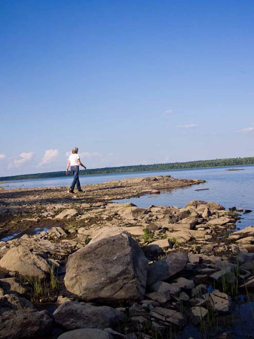
We stop several times along the way, mostly to take in the water views, and on the shoreline of Caribou Lake we find a picnic spot and a peaceful shoreline of smooth stones. We don’t see or hear any other people, but an osprey calls and lands on a treetop, and I can make out the rust-colored roof of what must be a camp in the distance. By now, our white wagon is covered in a film of mud and dust. I’ve even got dust on my lips. It’s getting to be late in the day by the time we reach the Abol Bridge again, and watch puffy clouds unfurl over Mount Katahdin. At the outer edges of Millinocket, we turn off the Golden Road just past Ambajejus Lake and follow signs to the River Drivers Restaurant. There, as the sun sets on Millinocket Lake, we order a couple bottles of Long Trail Ale and a steaming bowl of Prince Edward Island mussels. The Golden Road has shown us another uncommon day, and we end this trip with mud on the hems of our jeans, and our curiosity sated—for now.